The story of the land

The siltstone and mudstone sedimentary bedrock on which you stand was formed over 400 million years ago during the Silurian period. The ridge and valleys either side were created by later glacial movement.  The stream and river bed contain till, unsorted and unstratified drift, deposited directly by and underneath the glacier comprising a mixture of clay, sand, gravel, and boulders varying widely in size and shape formed between 116,000 and 11,800 years ago during the Quaternary period. Look into the clear waters to see the variety of stones in all shapes and colours, many contain fossils of small marine brachiopods, gastropods, and corals.   

Today the waters are home to the White-clawed Crayfish, a threatened keystone species. The crayfish here may have their origins after the retreat of the glaciers recolonising southern Britain either naturally through post glacial connections with France or by human reintroductions. The White-clawed Crayfish need mineral-rich water to fortify their exoskeleton and are particularly vulnerable to pollution incidents and high turbidity. We monitor our water quality as part of the Friends of the River Wye citizen science project. The presence of the crayfish are a sign of a healthy ecosystem. We have observed a buzzard feeding on crayfish and were delighted to find spraints on a bank of the river and photograph a dog otter on one of our wildlife cameras!

The mixed woodland that follows the river and stream valleys is classified as ancient woodland with many key indicator species including bluebells, wood anemones, sanicle, wych elm, yellow archangel, dog's mercury and opposite-leaved golden-saxifrage. Polypody ferns, mosses, lichen and liverworts indicate that we are on the boundary of temperate rainforest.

Set in this ancient landscape of rock, flora and fauna there is a long history of human habitation. Bronze Age cairns are numerous on the moorland 2.3miles north west of Cefnmachllys on the edge of Brycheiniog Forest. Hillforts dating to the Iron Age occur throughout the area. 1.4 miles to the south east lies the Iron Age Pwll-y-Cwrw fort enclosure south of Caebetran Farm and 1 mile to the west lies the well-preserved Twyn-y-Gaer Iron Age Hillfort. This land was home to the iron age tribe of the Silures. One can imagine the ridge on which Cefnmachllys stands as an ancient routeway across to Llandefalle Hill.

In the ancient Welsh kingdoms during the 10th century the ‘Cantref’ became the recognised unit of political and social organisation. Larger ‘Gwlads’ such as Brycheiniog were divided into Cantrefs possibly in the period 942-950. Brycheiniog was divided into three Cantrefs, so named after the then king of Brycheiniog and his brothers; Tewdwr, Selyf and Einion.  Cefnmachllys sat within Cantref Selyf. The area was defined by the boundary of the River Dulas and its confluence with the River Llyfni in the east and it extended north to the south side of the Builth district. Cantref Selyf comprised this mountain land south of Builth and to the west of the River Wye including Mynnd Epynt and Llandefalle later forming the forest lands of the Lords of Bronllys. 

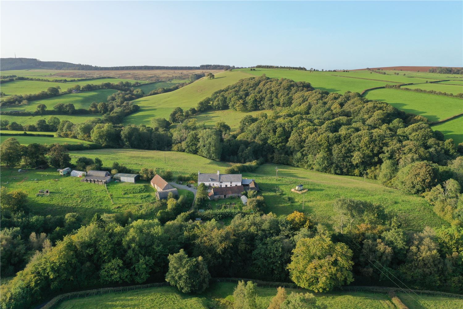
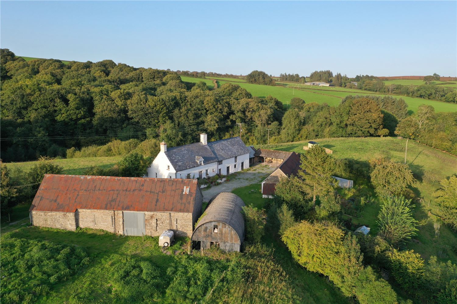
The administration of Cantref Selyf held influence over the farming practices at Cefnmachllys, indeed at the corner of Cefnmachllys lands Ynys y felin (mill island/ water meadow) at the confluence of the River Dulas and the brook which runs south of the farm lie the ruined remains of a watermill run by the monks or lay brothers of Dore Abbey as part of their holding in Cantref Selyf. In the 19th century it was run as a corn grist mill.

The Norman Conquest of England was followed, in the late 11th century, by a series of incursions into Wales from Castles built at strong points in the Marches. Norman knights were rewarded with grants of confiscated land.

One such knight was Richard fitz Pons of Clifford who built a timber motte and bailey castle at Bronllys in 1086 (4.9 miles east of Cefnmachllys). In 1116 Richard fitz Pons established himself of lord of Cantref Selyf. In 1138 Richard's son inherited Bronllys Castle and the lordship of Cantref Selyf and took the name Clifford. Walter de Clifford I (1113–1190) became the Anglo-Norman Marcher Lord of Bronllys Castle and feudal baron of Clifford, seated at Clifford Castle (just north of Hay-on-Wye). He was a benefactor to several monasteries, including Haughmond Abbey, Dore, and Godstow.

The immediate area has connections to the Cistercian abbey of Dore that was founded in 1147 and patronised by the Cliffords against a backdrop of intermittent warfare and military intrusion into the kingdom of Brycheiniog. Walter Clifford and his wife Margaret Tosny granted their northern lands in Cantref Selyf and the Epynt mountain to Dore Abbey on condition that they founded an abbey at Trawscoed (1.2 miles south east of Cefnmachllys). This foundation duly took place, probably around 1172-74, but within twenty years the abbey was suppressed by the monks of Dore with the consequence that a long dispute erupted between Walter Clifford II (1160-1221) and the monks, which was only finally settled with the agreement of his son Walter Clifford III (1190-1263). Walter Clifford III, confirmed the lordship of Llaneglwys to the north west of Cefnmachllys to the monks of Dore probably in June 1220.

The abbey at Trawscoed is recorded by Gerald of Wales, who stated that its mother house of Abbey Dore had reduced Trawscoed from its conventual status to that of a dependant grange by the early years of the 13th century. Gerald also mentioned a visit to the abbey by Abbot Canawg of Cwmhir. There are suggestions that the reason for the suppression of the abbey was probably that it failed to achieve a sufficiently large community, but political considerations may also have been significant.

In a description of the boundaries of Gwenddwr and Llaneglwys in 1241 Walter de Clifford II grants that the monks and their servants shall have free passage, ingress and egress in all of his land of Cantref Selyf with their chattels through all ways and paths where other men were accustomed to go.

Walter also acknowledges and grants to them specified common for their beasts and sheep of Trawsgoed and Wernddyfwg over pasture throughout the land including over Llandefalle... to the Flemish way, saving the corn and meadows of his men who have lands in the said pasture. He also acknowledges and grants to the said monks pasture and common in wood and in herbage of all his land which lies south of the Flemish way... down to the head of the river Dulas and thence to Tuchlar Duueleys (either referring to the confluence of the river Dulas and the stream two fields to the north west of Cefnmachllys or Talachddu to the south) so that they shall have free pasture within the aforesaid for their breeding horses... and so that in those places they may take in the wood what they should require to the grange of Trawsgoed and Wernddyfwg for building, fuel and hedges...

Our neighbouring farm Wernddyfwg some 730 metres north east of Cefnmachllys was a Grange Farm for Dore Abbey.